Recently, Prime Minister Imran Khan launched the digital cadastral map of Islamabad. This project is part of a larger Cadastral Mapping Project that aims to modernize the old Patwar system into an up-to-date digitized land administration. The project had been assigned to the Survey of Pakistan, which used the Geographical Information System (GIS) to map out the digital cadastral map of Islamabad. For the digital cadastral map of Pakistan, the Survey of Pakistan has completed the digitization of a total area of 943 sq km that includes 400 sq km of land under CDA and 545 sq km of ICT rural areas.
The digital mapping project will facilitate the government in dealing with issues like land record tempering and help to ensure monitoring of construction through imagery. The digital map will also provide information about land ownership and land titles. According to the National Coordination Committee (NCC) on Housing, Construction and Development, provincial governments should expedite legislation to prevent unapproved land-use changes and protect existing green spaces. Moreover, the cadastral mapping project will help the country in developing an authentic land record database.
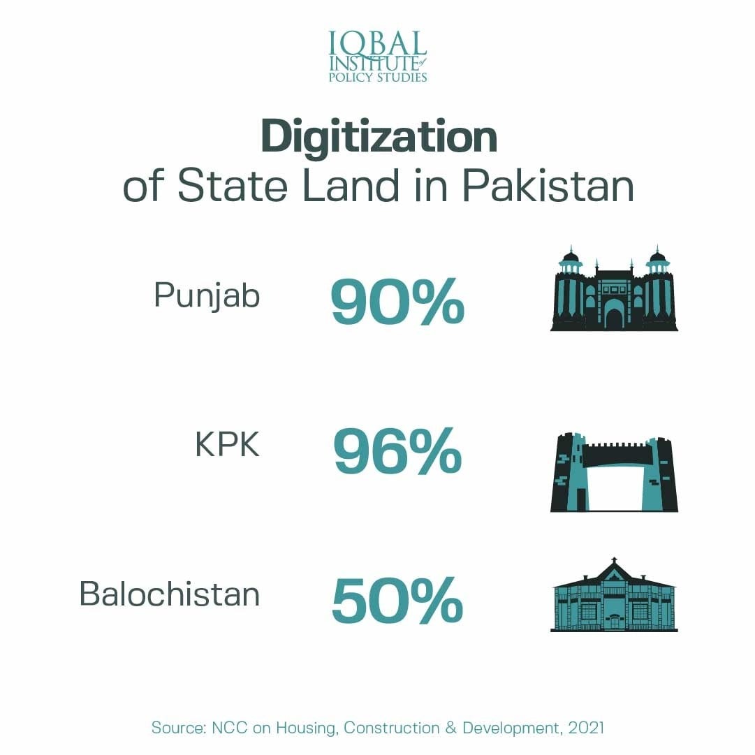
This feature would help in collecting revenues received from lands in the form of taxation and regulatory fees. In addition, this can help keep land-use changes in check as authorities can be notified in case a green space is converted into an urban project. According to the NCC, under phase-1 of the mapping project, 90% of the state land has been digitized in Punjab, 96% in KPK and 50% in Balochistan.
Leave a Reply